It’s becoming harder and harder to get a homeowner insurance policy in California. State Farm and Allstate stopped writing new policies, citing wildfire risks. Others are limiting new customers.
And now, several viewers tell San Francisco’s KGO-TV that AAA is not renewing their longtime policies – and it has nothing to do with wildfires.
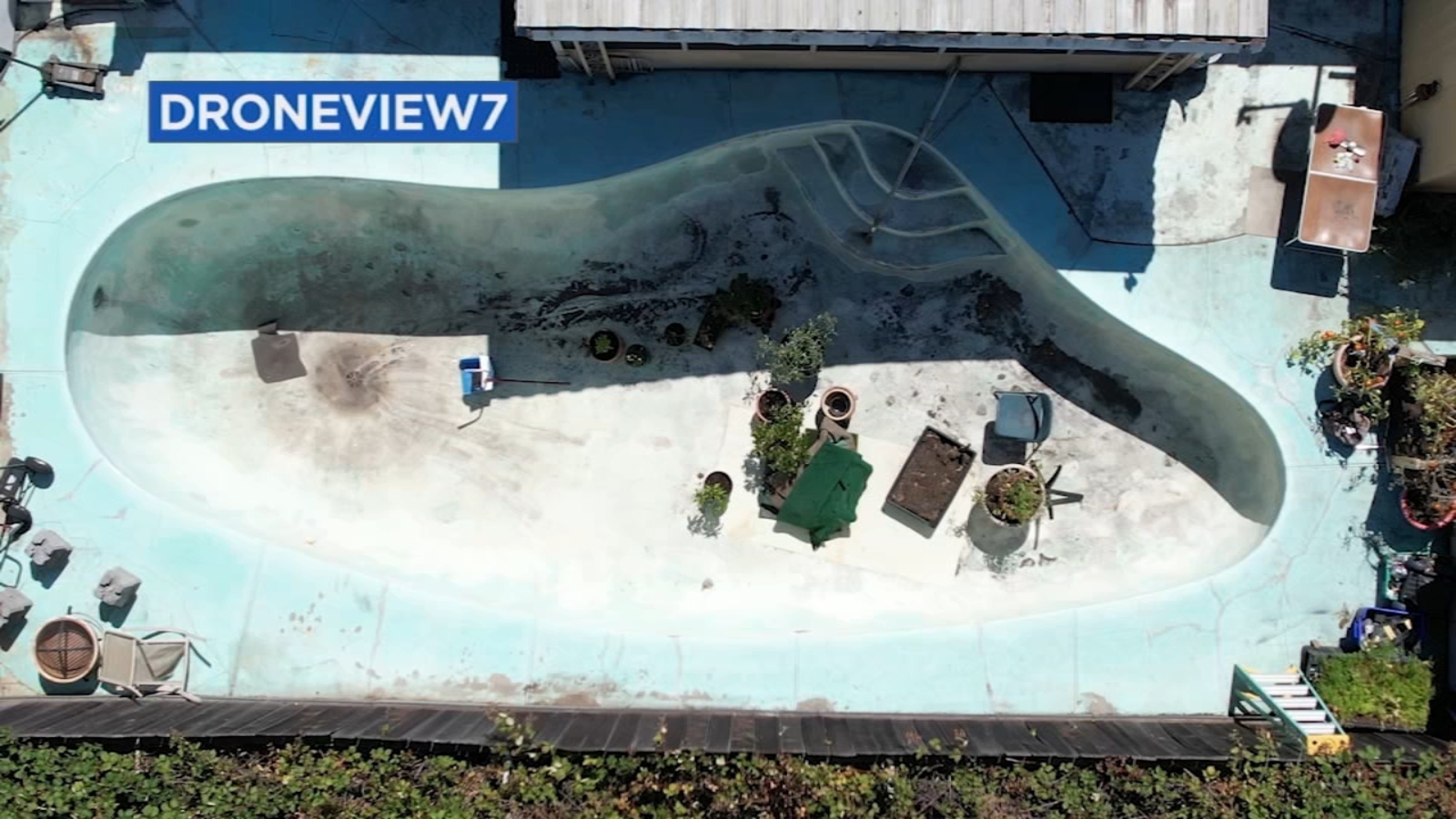
These homeowners were surprised to find out aircraft and satellites were taking photos over their homes. They were baffled to find out the reasons AAA dropped their coverage – everything from clutter in the yard to draining a swimming pool to save water.
Hello, do you buy this data or commission these flights as part of your job? What are these images useful for? I get the insurance verification, and some other uses like wildfire surveys and stuff but that’s about all I can think of. Road surveys maybe?
Can anybody commission these, in terms of permissions and in terms of cost?
Either way this is super cool info. Thanks for sharing.
I’ve been in the field of remote sensing since around the year 2000. Remote sensing data is used for literally anything you can think of. I started in sonar, but moved on to lidar and imagery (satellite and aerial), and some hyperspectral. If you want to build a highway, you fly lidar. If you want to build a building, you’ll use lidar. If you want to know where flooding will happen, guess what? Lidar. Plant health? Lidar or imagery, or hyperspec. Land cover? Lidar or imagery.
I’ve worked at pretty much every position in the stack, from field operator to senior scientist. My work these days focuses mostly on wildfire risk, carbon forestry, land cover, and outdoor water use.
Edit: And as far as buying data? Sure. No problem. But its not cheap. I got a quote for a client two weeks ago that was a 240 acre site and it was going to cost ~20k. This was for a very high resolution dataset, with a fair amount of processing.
https://en.wikipedia.org/wiki/Remote_sensing