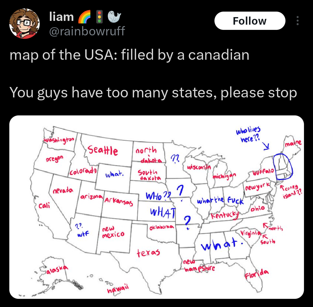
The Picard Maneuver@lemmy.worldM to Cartography Anarchy@lemm.eeEnglish · 4 months agoMap of the USA: filled by a Canadianlemmy.worldexternal-linkmessage-square63fedilinkarrow-up188arrow-down14
arrow-up184arrow-down1external-linkMap of the USA: filled by a Canadianlemmy.worldThe Picard Maneuver@lemmy.worldM to Cartography Anarchy@lemm.eeEnglish · 4 months agomessage-square63fedilink
minus-squareChaosCoati@midwest.sociallinkfedilinkEnglisharrow-up1·edit-24 months agoEast to west along the US border is Quebec, Ontario, Manitoba?, Alberta?, and BC. I think. Then there’s Nunavut. And maybe Nova Scotia, New Brunswick and Newfoundland? I’m realizing I have no idea how many provinces Canada has Edit: Looked it up and I definitely missed a few

East to west along the US border is Quebec, Ontario, Manitoba?, Alberta?, and BC. I think.
Then there’s Nunavut. And maybe Nova Scotia, New Brunswick and Newfoundland? I’m realizing I have no idea how many provinces Canada has
Edit: Looked it up and I definitely missed a few